PCT Day 114

Start: 1833.2

Stop: 1854.2

Today’s miles: 21

Total PCT miles: 1706.4

My dogs are barkin! At lunch today, Strider looked at my food with me to make sure I wasn’t setting myself up for failure. The last two days have consisted of me not eating nearly enough calories for the work I’m putting in, but I also think I need to add another day, stretching my low amount of daily calories one more day..

I do have enough to get me to Cottonwood Pass and do Mount Whitney.. but I split up one of the days because after today I realized it’s just too dang much! If I’m wrong, no worries, I’ll just keep hiking and make a new plan, but for right now.. slowing down the next 3 days over the hardest 2 mountains sounds way better to me than my original plan. Oh, the Sierra! Always ready to blow your mind and make you lose your mind too!


I ended up pushing snooze this morning for 10 extra minutes.. I yelled to Strider to let her know, so she wouldn’t be out packing her tent in the dark while I was snoozing still haha. I finally started moving at 5:40 and we were both packed and on trail by 6:10. Not too bad at all! As we started walking, our headlamps put away since it was bright enough (just barely) to see the trail, I told her about my 3:30am adventure, and how I almost screamed for her because I scared myself so bad..


I woke up at 3:30 and had to pee. Like bad. So, I put on my crocs and get my KulaCloth and head outside my tent. We’re camped on sandy rock between massive slabs of rock.. with a couple bushes around. I remembered from setting up that I needed to go on the slab, around the bush, and down some-and then I’d be on scrub brush and sand-not rock.


So I do. And I pee. And then I get so completely disoriented that I couldn’t find my way back to my tent. I walked slowly, felt for the bush.. noted that the rock I was back on was now suddenly sloping wayyyy down and not in a safe way. I literally started to panic and almost screamed, like her name was coming out with the next breath, when I realized I was standing right at her tent! One more step and I would have probably kicked Strider! I was so happy I found it that I almost fell into it! She’d really think I was a lunatic. Instead, I grabbed on to the bush beside her tent, slowly stepped around and over her guylines, and safely made it back to my tent. What in the whole hell?! No wonder I pushed snooze. I think the elevation had something to do with it, surely. Right? Ha


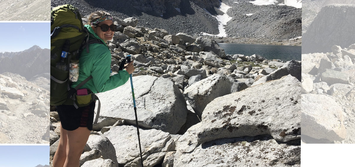
Anywho. We had 4 miles to the top of Mather Pass at 12,094 feet. I had been stressed about this one because of the snow comments-but-it was completely fine. The first 2 miles were meandering through alpine meadows, water was everywhere, there was a lake, and we were in the bowl of all of these massive mountains. We could see the sun shining on other areas, but it wasn’t high enough in the sky to warm up anything in the bowl we were in.


The next mile was tough, but the last mile about did me in. It was slow moving on trail surrounded by massive boulders. Up big stone steps and then crunching on loose gravel the size of coke cans. It switchbacked and became steep. There was a section with snow, hard as ice in the cold shade we were in. It had partially melted out in some places, so big sharp rocks were protruding through.. I had to step on the snow, not slip, step onto rock, and climb upwards too. It was maybe a total of 20 or so steps.. which I handled fine without microspikes. Once the snow ended, I had to rock scramble back up maybe 20-30 feet to the trail. Then onwards up I went.


The top was stunning all the way around, valleys on either side of the pass, one sunny and one still in the shade, both spectacular. I stayed up top only long enough to get sunscreen on and my sunglasses out, then I started the descent. It switchbacked down and had a little snow to go over too, but only one spot-everything else I could literally walk or scramble easily around. I met a guy doing the JMT and we walked and talked until I caught up to Strider, filtering some water.

She and I hiked through this valley together, 4 or 5 miles down before climbing again another 4 up Pinchot Pass at 12,127 feet. Two passes in one day! The valley stayed in the alpine zone, so it was cool and less buggy than the other valleys have been. I was so grateful. Lakes and scrub brush and tiny bits of grass all growing on rocks and sand. It’s seriously out of this world gorgeous.

We ate lunch with 3 miles to go to the top of the pass, only because I was getting dizzy and couldn’t walk much farther for fear of passing out. I was happy Stridor agreed to still eat with me, she usually eats her lunch an hour or so later than I do.. and I haven’t been eating enough calories in general through this stretch, so there was no way I’d have made it another hour.
I ate ramen for lunch, and it honestly really helped me get up to that pass.

Those last 3 miles took me almost 2 hours, but I was still moving faster than this morning. The rocks were steep, but the ascent had no snow that couldn’t be walked around. There were at least 3 incredible lakes, all snowmelt, that we walked by.. or climbed by I guess. The top was just as fascinating as Mather Pass, the beauty unbelievable. I was mesmerized. If there wasn’t all this beauty at the tops of these climbs, I don’t know that I’d do this at all. It makes everything so completely worth it.


I started the descent and was moving pretty quick on the switchbacks. It was still rock trail, but it was sandier and easier to walk on for awhile. Before it turned into huge rock steps.. those hurt. The views went from those gorgeous alpine meadows with water everywhere and birds chirping, to hot valley with a raging river next to the trail, and eventually into the forest. We were supposed to try to climb some of Glen Pass today, but when I finally caught up to Strider again, we were still a good ways away from the bottom of the descent, and it was getting closer to sunset.


Apparently the start of the climb has some significant avalanche damage. To the point it can take hours to get through. A man told Strider how to climb around it, and we did not want to get stuck in that with the sun setting. So, we’ll get to tackle that first thing in the morning I guess. We have a horrible 8.7 miles to the top of Glen Pass, then on the descent, Strider will take the junction over Kearsarge Pass to get into the town of Independence, California, and I’ll keep hiking towards Forester Pass. I’m aiming for less than 20 miles tomorrow and the following 2 days.. and then it’ll be about 20 miles exactly to get to Cottonwood Pass after Mount Whitney.


Let’s pray tomorrow goes well, I’m stressed about the avalanche debris and the fact that I’ll be hiking uphill for close to 9 miles. Yikes. In that case, time to get some sleep, 5:30am comes way too early for me!

PCT Day 113

Start: 1810.8

Stop: 1833.2

Today’s miles: 22.4

Total PCT miles: 1685.4

One word for today: brutal. So absolutely brutal. And yet-so breathtakingly gorgeous.. well, and just flat out breath taking, too.


I was cold throughout the night, if I turned a certain way, a draft made its way up my back. Once I retucked my quilt around me, I was snug and warm though. I got up and started packing at 5:30, knowing Strider was probably already awake and waiting to hear signs of life from me.. she’s an early riser, and I really just don’t know how she does it.


It was a very cold start to the morning, and in the darkness of the dusky morning, we saw three deer dancing down the trail above us as we packed up our tents. It was pretty neat to see. Later, after maybe a mile or so of hiking, we saw them again, eating just above the trail. The cold morning wasn’t causing any issues for them!

I took so many breaks on my way up to Muir Pass. We had water crossings early on, and I kept my feet dry some how, but as dry as my feet were, I was feeling everything but successful. I couldn’t catch my breath, like at all. I had to stop, let my heartbeat slow, take deep breaths that felt like they somehow STILL weren’t deep enough to make my lungs happy. At some points I was on the verge of panic, sucking in air like never before, and had to remind myself that I’ve done this before, I know how to be safe in high altitudes, I just had to slow my breathing and take my time and drink my water.


Knowing these things and making the panic subside were wildly different things, though. When I finally made it to the Muir Hut, this gorgeous rock hut at the top of the pass, I was exhausted and so short of breath that I was pretty worried. I had gotten a little lightheaded just before reaching the hut, and it was really freaking me out. I tried to hide it from Strider, who made it there way before me, but waited for me nonetheless. Man, she rocks. I told her I didn’t feel so great, so we snapped some pictures of the hut and then quickly started to head down the other side. The best way to fix issues related to the altitude is to go down.


I was very stressed out about the snow everyone had been talking about going down the backside of the pass, so, feeling panicky over my breathing soon turned into panicky over snow crossings. Several of the snow traverses were steep enough that I put on my microspikes. It was early morning and the snow was ice hard, so the spikes definitely helped give me traction. I don’t think I *had* to have them, but they did make me go through it a little faster, even if any speed gained was then lost by taking them off and putting them on again a quarter mile later. I think all in all, I put them on 3 times, and each time I was happy as hell to have them.


The sun cups were massive and the water cascading down trail from all this snowmelt was pretty massive, too. Water was everywhere: little lakes and ponds, streams and creeks and some that rushed like a full on river. The descent once the snowy parts were passed seemed to just go on and on forever. Thankfully, it was seriously beautiful. And, the highlight, I saw several picas and even got one on camera! They’re so dang cute!


Around 10am I finally got warm enough to take off my gloves and jackets. About 4 and a half seconds after that, it was so damn hot it felt like I was melting! The farther down into the valley we went, the hotter it got.. and the mosquitos and gnats came out in full force. So. Many. Bugs. Thankfully, we ate lunch before getting too far down into the valley, because as we continued that descent, the terrain got boggy and all around nasty. Muddy looking water, bugs galore-absolutely eating me alive-overgrown grasses and fallen trees.


As the trail started its ascent, the bugs didn’t stop. I got to the point that I was sucking them in trying to breathe-and ended up in my headnet, and dousing myself with a probably unhealthy amount of picaridin.. spray and lotion-no shame. Once the climb came above the thick tree line, the bugs stayed, but the absolute hell of it started to subside, the views came back.


That’s when the real fun started.. the Golden Staircase. The climb included very steep trail that wound itself up the cliff sides in what felt like vertical gain. It wasn’t of course, but it probably could have been if the trail maintenance folks hadn’t taken the time to create these massive stone steps up and through the steep cliff side.

It was somewhere on this Golden Staircase that the clouds rolled in and it started to sprinkle. I was actually happy, thinking it would knock down the bugs-but these are California bugs, they don’t follow the rules. They kept buzzing in my face at my headnet, even with the rain. Thankfully, the rain didn’t last but 20-30 minutes at the most.


The temperature started to drop as the sun started to set. I hadn’t seen Strider in a while, she’d stayed ahead for the majority of the day, but I did catch sight of her way up ahead on the switchbacks of the staircase. As the sun disappeared, I prayed that she would have her headlamp on so I could find her in the dark. I knew I would have a hard time figuring out where the camp sites were with my dim headlamp. The anxiety started to creep back in.

In my headlamp, unable to see much of anything for maybe the last mile of my climb, I spotted a light up ahead. It was Strider, she saved me a spot for my tent and had been looking for me to make sure I wouldn’t pass her in the dark! Ah, my hero! I quickly set up my tent next to hers on this gritty sand in between two massive slabs of rock. We still have 4 miles to get to the top of Mather Pass tomorrow morning. After the way this kicked my ass today, I’m worried about how I’m going to do tomorrow. I definitely think I’m not eating enough calories for the work I’m putting in. That’s pretty stressful, along with the whole getting lightheaded and not being able to breathe thing.


We ate dinner together sitting outside on the rocks, and then I finished unpacking. I’m now all snuggled in and ready for some sleep. When I get service, I really need to order a new headlamp. Mine just isn’t bright enough. Too bad I don’t have it now, when I feel like I need it most. I also want new gloves-WARM ones. Or at least 2 matching warm ones lol. Alright, y’all know that 5:30 wake up call comes way too early for me. And I’m absolutely spent. Sweet dreams!

PCT Day 112

Start: 1790.3

Stop: 1810.8

Today’s miles: 20.5

Total PCT miles: 1663

Well, I don’t think I’ve made it to camp this early in a long time! We made it to our stopping point by 5:20! The panicky side of me thought we should keep going, since it was so early-the common sense part of me saw the storm clouds ahead and was already getting cold: aka-don’t be dumb and go over a mountain pass 5 miles away right before dark.. and then have snow and rain to contend with on the other side..


Today was stunning! We crossed into Kings Canyon National Park! Our 6th park of the trail 🙂 Again I had moments of remembering certain areas from when Andrea and I came through on the JMT. It was all still just as beautiful and breathtaking today as it was the first time I saw it.

I actually got up at 5:30am, packed, and was walking to Strider’s tentsite just a few minutes after 6. She was putting her tent in her pack and a couple minutes later we were on the trail. I still had to use my headlamp for maybe 15-20 minutes, and then the sun started to light the sky enough to see where to place our feet. It was cold, but we were able to move quickly because the terrain was smooth and easy going. Thank goodness!

Photo taken by Strider


We had 9 miles to get to the first sketchy water crossing we’ve all been hearing horror stories about. The bridge over a part of the San Juaquin River was out because of the snow-so this is usually a river we’d never have to walk through, just over-but with the bridge gone and no easy way around-through we went! Earlier in the season it was entirely too dangerous to cross it, so the national park service was making people detour around, which added over 15 miles and they were forced to skip the iconic Muir Pass because of it.


We made it to this crossing by 10:30am, and a woman doing the JMT was there waiting for us, so we could cross together. Strider went first, then me, then her. It was COLD. It moved fast but it was honestly like every other cold water crossing we’ve gone through so far. The water only came above my knee in one spot and otherwise stayed right below. I think the river crossing that I forded with Heidi, Marquis, and Margot was way sketchier.. so this made me pretty happy! I have been so worried about it!


The trail started slowly climb upwards, surrounded by raging creeks and huge mountains. We got to Evolution Meadow and crossed Evolution Creek, another water crossing known to be potentially fatal if you fall in it when the water is high-mainly because right after the crossing spot, the water goes down some waterfalls-and that water was raging! Thankfully, it too only came to my knee and I felt very stable crossing it. We waited to go until after we ate lunch though.


The 7 ish miles after that creek crossing were a slow and steady climb towards Muir Pass, with one of those miles being less than gentle. It was sunny at the start, and buggy as hell, but then the bugs stayed and the sun departed for storm clouds around 2pm. We kept moving, praying it wouldn’t rain. The temperature as we climbed only got cooler, but the views became more and more epic. It was astonishing how quickly you can go from wooded forest to alpine lakes and scattered rocks.


We had to cross over a bit of snow, I slipped and landed hard on my left hip in a very easy section.. just goes to show you how much I dislike the snow! Lol-but, the really long snow field was absolutely fine.. even though there was a huge hole at one point and I almost panicked when I realized I was on a snow bridge and everything under me was melting out.


We got to where we wanted to camp and looked ahead at the sky: angry clouds were swirling in the exact direction of the pass. We knew we made the right call to not cross the pass in the late afternoon. There’s apparently more snow on the other side and we didn’t want to risk navigating that in bad weather or with the sun setting.. and then have to find a camp site too. No thanks!

So, we set up our tents on Evolution Lake, the upper part-which im pretty sure is where Andrea and I camped in 2018. Pretty neat. We unpacked and got water and ate dinner-all while shivering. I started out with a vestibule open, it’s closed now and I’m all bundled up. Tomorrow we’ll go over Muir Pass first thing, then down and mostly up Mather Pass, and camp just before like we did today. Again, I’m anxious over the snow, but there’s nothing worrying will do.


I think it’s time for some sleep (at 7:10pm!! Heck yeah!). We’ll try to get up early again tomorrow and leave around 6 to have a longer day of getting the miles in. Pray it goes smoothly! Goodnight y’all!