Day 115: Katahdin Springs Campsite

Start: Rainbow Stream Lean-To (AT mi 2163). Stop: Katahdin Springs Campsite (AT mi 2187.9). Today’s miles: 24.9 miles. Total AT mileage: 1162.9 miles


Y’all! I’m in BAXTER STATE PARK!!! I’m so flipping excited! I’m going to summit Mount Katahdin tomorrow and finish part one of my journey: Making it to the Top of Maine! Wow.

Just another misty morning 🎶


Ok, so, this morning I got up at 5:35 and started packing up as quietly as I could.. which isn’t quiet at all really. But as I was, the only other 2 hikers there started to do the same. We all had that same urgent “must get to Baxter” feeling going on apparently.


I was on trail by 6:05, impressively. I made good time even while trying to force myself to choke down my probar. I sat down to slowly eat this morning instead of eating while walking like yesterday, to see if I’d have a better result. I still gagged the whole time eating it, so I’m not really sure what’s going on with that.. I used to love those things! And I need the calories and energy they give. The other protein bars have me so hungry within an hour of eating them.


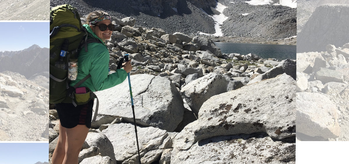
Anyway, the miles cranked out quickly. It wasn’t smooth trail per say-there we’re roots mangled and tangled and intertwined all over the place, with rocks here and there, too.. so while it was mostly “flat” my feet continued to take a beating. Even still, I pushed on, too excited to exit the 100 mile wilderness, figure out my fate for the rest of the day and tomorrow.. ahhh! So much was swirling around in my head to even give the terrain a serious thought. I stopped for water sometime around 9am and realized I had already gone over 9 miles! It was only 15.5 total to Abol Bridge! My back up plan for tonight if I couldn’t get into Birches!


At 10 am I made it to Rainbow Ledges and turned my phone’s airplane mode off. I waited and waited for enough reception to make a call to reserve a bed in Millinocket for tomorrow night, and for the shuttle from Baxter to the hostel. It took 2 dropped calls and a lot of repeating myself to make it happen, but happen it did! I sent my mom and uncle Keith a quick text, but I didn’t have time to wait for replies.. within 5 minutes I was already back in the “No Service” zone. Damn.


I put it back into airplane mode and kept going. I won’t have any more service until I get down to town tomorrow evening. It looks like that’s when I’ll be playing catch-up on my posts and whatnot. I passed several people hiking SOBO with ginormous packs on their backs. Clearly this is their day one, and man oh man, I remember my day one. I could feel for them! Their backs are going to be so sore tomorrow morning!


When I came out of the 100 Mile Wilderness to the road to Abol Bridge, Water Queen was set up doing trail magic!! There was practically everyone I had been camping around the last few days hanging out, eating hot dogs and chatting. She had pictures up of all the thru hikers she’s done magic for this year and “congratulations class of 2021” signs and banners! I know it’s sappy, and I’m not technically almost done, but I choked up a bit.


I sat and had hotdogs and my beloved Mountain Dew. Everyone was chatting about their plans for summiting. Water Queen told me the sign up sheet for Birches is already full for tonight. Birches is the Lean-To for thru hikers only-they only allow 12 people per night, and it’s first come first serve at 7am the day of only. The reason people want to go there is it’s 10 easy miles from Abol Bridge to Birches, and it’s right at the base of Katahdin, making the climb the next morning 5.3 miles.


There’s also a campground, Katahdin Springs Campground, next to Birches, but it gets sold out months in advance by people driving in to visit the park, and securing a spot there is pure luck and usually unlikely. So, the only option really besides those two is to pay to camp off this road, right outside the state park and be in line first thing to sign up for Birches the next morning and summit a day later, OR get up super early and hike from here into the park and up Katahdin all in one day, which is ~20 miles.


The trick with that is, you have to be at the ranger station by Birches to get your permit to summit no later than 11am or they won’t let you go up Katahdin. So, that’s 10 miles before 11, plus 5 miles straight up a 5000+ foot mountain, 5 miles back down, and the shuttle to take you out of the park leaves at 3pm. Haha-no pressure.

I made it out of the wilderness!


So, as we’re sitting around talking, I’m realizing that this last option is what I’m going to be doing tomorrow. I mention that I was going to start looking into campsites nearby as everyone was getting up and starting to walk. Sunny mentioned they have a campsite they snagged, but sadly there’s no more room because they already have 8 people staying.. no worries I tell her. It’ll be ok.

While we’re all walking the quarter mile to the store, we cross the actual bridge over the river-we see Katahdin standing proud out past the water.. and then see a bald eagle flying! Seriously!? It was phenomenal, and such a perfect piece added to an already awesome day.


Then, when I get to the Abol Bridge store, everyone from that group meets up with Cactus and Cousin Eddie. I go in and buy a beer, and when I come out they yell for me.. Cactus and Cousin Eddie have signed up at Birches already for tonight, but they’re going to stay at the campsite with all their friends (they’re part of the 8 and no one realized they had signed up) so they offer me one of their spots! I was ecstatic!!


I finish my beer and start walking the mile to the sign up kiosk thinking a ranger would be there.. there wasn’t. So, I signed in anyway and looked over the log ins.. Poptart was on there!! She is at Birches tonight!! TieDye has a campsite at Katahdin Springs!! He’s there tonight, too! How in the world!!?! I headed up the trail, praying like hell that they would believe me about Cactus not coming and giving me her spot, and wouldn’t turn me away after hiking 10 miles to get there. I was also so dang excited that I’d be seeing my friends. If not tonight, tomorrow somewhere on Katahdin! It’s all going to work out!! The trail provides!


The trail was beautiful and followed along a river for a long time. It eventually got rooty and painful, but I think down feather pillows would be painful after hiking 50 miles in 2 days. I stopped and got water 5 miles in, and turned on some music to keep me motivated. And at 5:25 I passed the sign to take me to the ranger station at Katahdin Springs Campsite, and moments later I saw a man through the woods getting water-with a tent set up back behind him. It took me a nano second to register and yell out a “TieDye! Is that you!?!”


I’m not sure if it’s luck or Devine intervention.. but it was indeed TieDye, and I’m thinking it’s more on the side of the Devine than luck. He got a campsite by finding a cancellation last night in town when he and his wife stayed in a hotel! He and his new friend, Rippin Riles had room for me to share their site with them!! WHAT!? I was so happy I jumped around a bit and squealed! I dropped my stuff and they told me how to get to the ranger station to register so I could get my permit to summit and not have to wait to get it in the morning.


I headed that way and signed in, got my permit, had all my questions answered. And, then like a crazy person, I walked an extra half mile to Birches campsite to surprise Poptart! I hung out with her a bit, she actually gave me a Poptart for tomorrow after I told her about my gagging business. Lol. I’m so dang thrilled I got to see her, she steadily keeps me laughing and is always in such good spirits! This day has seriously left me speechless when it comes to the gratefulness Im feeling.. for getting the chance to spend these moments with people I’ve come to care about. I said my byes and then got back to the campsite to set up my tent, do my chores, and eat my dinner.


It was so hard getting it all done, I’m pretty wiped today. But it had to be done. Today all worked out better than I could have ever planned for it to! Now, all that’s left to do is get some sleep and then summit that big ole mountain tomorrow.. and then start the second part of my journey: Heading Home. Goodnight, y’all. Prayers for good weather tomorrow.

Day 114: Almost a Marathon Day!

Start: Stealth Site (AT mi 2136.9). Stop: Rainbow Stream Lean-To (AT mi 2163). Today’s miles: 26.1 miles. Total AT mileage: 1138 miles.


I got up at 5:35 and was hiking by 6:06am. 10 extra minutes of sleep and only one minute later for leaving.. not too shabby. Because I knew the terrain would at the very least start off “easy” I decided to eat my Probar breakfast while walking, so I wouldn’t disturb Babbit and friend any longer than necessary this morning.


I was doing well, walking and eating.. that’s how you know the trail is actually easy, I didn’t choke myself! However, half way through my probar I got nauseous. That’s weird. I went for another bite and literally gagged. So, I put the rest up and drank some water. I just must not be that hungry. So strange.


The weather was noticeably less hot than yesterday, and it didn’t feel humid at all. It is such a relief! I made great time all morning, like I was set on cruise control. When I felt my stomach starting to complain, I originally went for the rest of the probar, but then my stomach lunged.. so, I ate some sour patch kids candy, instead. The burst of energy from all the sugar seemed to help and it didn’t make me want to retch, so I took it as a win.


I ended up keeping my phone in airplane mode but decided that since today would be my longest day, mileage wise, on trail to date, that I’d listen to an audiobook. I listened to “After You” by Jojo Moyes.. she wrote the book I love “The Giver of Stars” and I hadn’t realized that she’s the writer of the book “Me Before You” which was turned into a movie with Emilia Clarke.. anyway, I loved that movie.. and this audiobook picks up where the movie left off, so as I was walking I was picturing the characters from the movie. It was awesome.


Back to normal stuff, I saw a snake and actually managed to get a picture since he didn’t sneak off quickly with my scream. Actually, he didn’t seem to care much at all about me.. lol it still boggles my mind that people choose to have snakes as pets (I’m talking to you here, Ken). Like, why? You just like nightmares every night?


I stopped for lunch on a fallen log just after 12 noon.. peanut butter and jelly on a tortilla. It’s way easier to eat than the tuna. I don’t think I’ll ever be able to stomach another packet of meat. Only 3-4 more months of dealing with trail lunches to go! I sat for close to 35 minutes, slowly eating my tortilla and munching on chips, entranced in my book.

After fueling up I hit the trail, and to my complete shock: I went up another mountain. I wasn’t expecting it, as the elevation map looked flat overall.. but there it was, right smack in front of me. As I started climbing up roots and rock steps, I rechecked the map. I’ll be damned. If you zoom in, there it is: Nesuntabunt Mountain, elevation 1,522 feet. When you ate lunch at under 500 feet of elevation, this comes as a punch to the gut, and even the spirit a little as dramatic as that sounds.


Since I wasn’t expecting it, I had half a liter of water on me. I’ve noticed I tend to chug my water, especially when going uphill. So knowing I *couldnt* just chug when I wanted to, or else I’d be stuck hiking miles with no water.. I was annoyed with myself. Even still, as I turn a curve and walk out on a rock slab with a view.. I realize the mountain i was seeing in front of me across the lake was Mount Katahdin. Oh my God, she’s a beauty.. jutting up out of the ground-standing higher than anything else around me for miles and miles. Just. WOW.


I was grateful for that moment to distract me from the lack of water situation. I continued on and once at the top I drank the rest of what I had and started making my way downhill, looking for the next water source. According to my maps it would be a pond about 2 miles ahead. Ok, I got this. I had already hiked close to 20 miles at this point, it was just after 3pm and I still had 3-8 more miles to go.

The mountain in the background: Mount Katahdin


I was hoping the terrain would have stayed the way it had been earlier in the day, but after the descent of that mountain, the roots came out to play. Even when it was technically flat trail, the roots were everywhere causing my feet to throb with every step. When I made it to the pond I filtered water while sitting in the sun on a big rock slab. My feet were just so achy.. I sat for maybe 15 minutes and had to force myself to get moving again. Each step hurt, and my book finished so I had little to distract me from the pain. I thought about turning on some music, but I didn’t want my battery to drop any lower. Ugh.


I passed up the place I could stop at 23 miles to keep hiking to Rainbow Stream Lean-To. I decided that the only way I could stop to camp before that shelter was if I happened to pass TieDye or Poptart stealth camping.. AND there was a place for my tent, too. It was sad but good that neither of my friends appeared, because at 6:35pm I showed up to the lean-to making this a 26.1 mile day! ALMOST a full marathon! Because I was so close, 0.1 away from a marathon, I almost hiked across the creek to set up camp down trail a little bit, but it was getting dark and there were no spots on the app suggesting anywhere to camp, so I made due being 0.1 short of awesome. Such is life.


I found a flat spot up the hill from the shelter and set up. Then had to force myself to go do the rest of my chores: bathe, filter water, eat dinner.. it all felt like so much more work! But I did it. The water was warmer than expected, but the air temperature was definitely cooling off more. It’ll definitely be a better night of sleep! I ate some ramen and my stomach felt like it wouldn’t tolerate much more. I hadn’t been queasy since probar breakfast, but I wasn’t about to risk it happening again right before bed.


So, thanks to my long day today.. I’m on track to summit Mount Katahdin on the 29th! Tomorrow will either be ~15 miles to Baxter State Park border and camp there to do 20 miles on summit day, OR ~25 miles to Birches inside BSP and only 10 miles on summit day! It’s out of my control to which option I’ll have given to me-I’m praying on the 25 tomorrow and 10 the following day, but either way-I’m summiting that mountain Sunday!!

Day 113: Stealth Site near JoMary

Start: Sidney Tappan Campsite (AT mi 2116.4). Stop: Stealth Site (AT mi 2136.9). Today’s miles: 20.5 miles. Total AT mileage: 1111.9 miles


I’m not 100% certain, but I’m pretty sure today was my longest mileage day on trail so far! By a whole 1/2 mile.. lol, whatever, it totally counts! Today was also when I crossed my halfway point for the full thruhike! At mile 2121.55 today I had officially walked 1096.55 miles, or half of the Appalachian Trail’s 2193.1 miles. It’s both exhilarating and a little deflating, too. How can I have been through and accomplished SOOO MUCH to only be half way? Well, I’m over half way now, technically, but whatever, you get my point.


I slept like a log, and it was fantastic because I assumed I’d sleep poorly with all the people around. When my watch alarm went off at 5am, I turned it off, but took out my ear plugs. I could here other people stirring, packing, getting ready. I let myself doze back off and woke to a light in my face from across camp. People really are oblivious with their headlamps, and this one was not a red light. Double rude.


I went ahead and got up at 5:25 and started packing. Some mornings I think I’ll be quicker than the previous, but it almost always takes me 40-60 minutes to pack up, eat, brush my teeth and get my shoes on.. not necessarily in that order lol. I was the second to last out of camp, at 6:05am. Lord, food drops really make people push!


I was pretty impressed with myself today. I had to go up and over 4 mountains total, the first 3 right at the start of my day, the 4th just before my food drop. I made it to the top of the first one by 6:35, down and up the second one by 7:20, and down and up the third one by 8:15! That’s a lot to get done in a short time. It was technically 4 miles of work.


The climb up West Peak had an elevation gain of over 700 feet. It was steep of course, but it wasn’t terrible since the trail maintenance folks literally put in rock steps (smallllll, short steps, not big lunge steps) most of the way up! I mean, I was sweating enough by 6:20 to bottle my own perfume (we’ll call it “Mademoiselle Hiker Trash”) so it’s not like it was easy.. but it was enjoyable in some psychotic way. Sadly, either there was no sign at the top or I missed it somehow. That was disappointing.


The descent was maybe 300 feet from West Peak and then immediately up 400+ feet of gain over a mile long to get to the top of Hay Mountain. It was easy going and gentle, mostly just not steep like the others have been. I did finally get a picture at the top! Lol if you’re going to make me climb something, at least let there be a sign if there’s no view to prove it!


It was 200 feet of elevation loss to get to the junction I crazily thought I’d camp at last night. As nice as these mountains are being to me today, I wouldn’t have felt the same way at 8pm last night, toting extra water! Haha I definitely made the right call! Because then, it was up another 700 feet of elevation gain over 1.2 miles. It had steep chunks with nice steps. It had steep chunks without nice steps. And for fun they through in some random flat trail that made me think I was almost at the summit when I wasn’t even half way yet. Lol


The top of White Cap Mountain was gorgeous with a sign AND views! Sadly, it was hazy so I couldn’t quite make out Mount Katahdin in the distance, but apparently on clear days, this is the first place you can! It was 8:15 and I was still on track for getting to my food drop on time, so I sat a minute and caught my breath. I drank my water, soaked in the views, and then put that sweaty pack back on to start making my way downhill.. for 7 miles.


People naturally think downhill is easier, and better.. and yes, it is less taxing on my lungs and breathing ability.. but good God it’s tough! Even though today’s 7 miles of DOWN was well maintained and had nice steps and only a very few hard drops for my joints.. my feet are throbbing like crazy right now.


I made it to the first shelter on the way down and used the privy! I was so proud of myself for being able to wait to use it.. but I really had no choice with the steepness of the trail and no where to step off trail to.. haha. It could have been a disaster! Afterwards I filtered water, chugged one full liter then packed the other one to go. I also ate a protein bar. Then it was back on trail and back downhill.


As I got closer to the bottom, the terrain got smoother and flatter and prettier. I was cruising along and felt great, despite the heat and humidity turning me into a pile of mush. I was almost to the next shelter when I had to detour suddenly to dig a cat hole. Like, so much for being proud of the privy.. it didn’t last long. As I was handling my business, a hiker passes. I realize that I did a shit job of hiding myself in these trees.. but luckily when he spotted my pack he kept his eyes forward. At least there’s that! Less than 15 minutes later, when I passed the shelter, it had a BRAND NEW gorgeous privy. Seriously?! Ughhh. So ridiculous!


I carried on and started my climb up Little Boardman Mountain. Well, it had a hill first, then a sweet flat chunk, then the steep climb up the mountain. Before I could even finish the flat area, I had to stop and eat another protein bar. It was 12:30 and normally I’d have eaten lunch by now, but I didn’t want to sit down and unpack my food bag when I’d be doing that soon enough anyway. So I opted to eat the bar and then eat lunch after I got my drop.


I made it to the top of the mountain by 1:08. I chugged the rest of my water knowing that in less than an hour I’d have a cold PBR in my hands. Which is exactly how that played out. I went down the mountain and got to the road crossing at 1:43, and waiting for me was Mike, from Shaw’s Hostel with my food drop and a cold beer. I flung my stuff down and sat down to drink. I told myself to savor it, but I don’t know how to drink anything slow when I’m so dang hot! The heat going over that mountain was close to unbearable.


I sat and chatted with Mike for a good 30 minutes or so. I packed all my new food and Mike was kind enough to give me a Coke to drink, too. He’s from Kennesaw, right down the road from me, and he comes up here to the hostel to help out over the summer! He’s been doing that ever since the summer after he did his thru hike. The AT is slap full of incredible people, and incredibly kind ones at that.


When I finally left Mike, I walked maybe a quarter mile to a beach on Crawford Pond. The water was completely clear! I got strait in and swam, cleaned my skin as much as possible. My lovely heat rash is back with a vengeance thanks to the last couple days. It’s crazy I can tell now when it’s going to start popping up.. and it was completely cleared up before I came back to Monson. Heartbreak hotel. Itchy hotel, too. Anyway, I didn’t stay in very long, because the rash was burning.. lol.. and storm clouds appeared to be rolling through.


I dried out on the beach sitting on a log eating my lunch and filtering more water. Again, I chugged one and took one with me. The rest of the trail was mostly smooth and flat with gentle ups and downs that you couldn’t even notice. There were a few boggy boardwalk deals, which always equals bugs. But otherwise it was a lovely way to end my day! I walked almost 7 more miles, just before Jo Mary Road to a stealth site that Mike told me about. I managed to make it there by 5:30pm, after crossing 4 mountains, getting a food drop, swimming.. and Im right on the river!


I got to bathe again in the river, and while I dried out I set up camp. My clothes are damp but it’s supposed to rain tonight, AND the temperature is supposed to drop, too. Man, I hope that part of the forecast is accurate. While I was eating dinner, Babbit appeared with his friend! The two of them are camping with me tonight, and they only have to go to this road (a whole 0.2 miles from here) to get their food drop in the morning, at 10am! Lol-im jealous they get to sleep in!


It’ll be another early morning and long day for me. I’m beat after this 20+ mile day, but im going to try to push it to 23-28 miles tomorrow. It sounds crazy to me even typing that out, but the terrain is easier than it’s ever been, if it’s like how this last 7 mile stretch was anyway, and if I can make it there tomorrow then I can still be on track to summit on the morning of the 29th in good weather. That’s the plan anyway!


My feet are still throbbing and im so sticky hot again. Looks like it’s time to attempt to fall asleep anyway. It’ll be morning before I know it! Goodnight y’all!


Ps: I saw 3 snakes today, almost stepping on 2 of them! All during the same 30 minutes on the downhill off of White Cap Mountain. Yes, I screamed and carried on like a toddler. Some things don’t change. Haha