Start: 1423.2
Stop: 1439.8
Today’s Miles: 16.6
Total CDT miles: 1111.6
I tossed and turned a lot during the night, and my face kept getting swarmed by a single mosquito that I couldn’t manage to kill. I’d bury myself in my quilt, then get too hot and pop out.. and wouldn’t you know, a second later that damn mosquito would be buzzing right by my ear. Damn bugs.

I will say, I got to see a spectacular sunset and an even better sunrise. The orange glow of the morning sun behind the black of the mountains and the night sky-out of this world gorgeous.
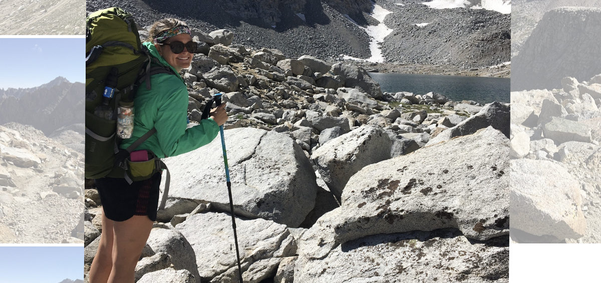
I packed and was on trail by 6:40am, and was actually getting up that 0.5 miles to the hut at the top of the climb without too much issue. I saw cute marmots at the top, known for being too friendly and stealing folks food and eating their trekking poles.. I decided not to try to pet these. Haha.
I walked past the hut and saw a perfectly maintained trail heading downhill, so off I went. About half a mile or so later, I realize I’m standing in the middle of a rock scramble and have no idea which way to go.. I pull out my phone, and realize I’ve gone down the wrong side of this mountain top! And it’s not like you can just walk across to the correct side-there’s nothing but sheer drop offs all around. So, I start hiking BACK up to that damn hut.

At the top, I check my map, and start following the trail. After several very steep switchbacks, I see a spot way below that looks like the spot I slept in. Hmmm. I pull back out my map. SON OF A BISCUIT EATING BULLDOG! I went down the way I had originally came UP! So I had to climb back up to that hut for a 3rd time!! Oh my god! I was ready to sit down and push my SOS button and tell search and rescue to come get me because I’ve clearly lost my damn mind!
Angry as all get out, I stomp back up there, and go off the side of the mountain with zero trail visible but the correct way according to my map. No wonder I missed it! I was fuming the whole way down. It was very steep, which is tricky in my sandals, but I never fell. Surprisingly. The “trail” or lack there of, went down and then across a mountain top, and then in the distance you could see actual trail again.. I still kept pulling out my phone to double check myself. I am NOT backtracking again.

The rest of the day felt like going from exposed ridges-up and down and across them-into deep woods, with all the fallen trees to clamber over-back straight up and across more ridges. It happened so many times, I’ve lost count! The views on the exposed mountain tops were stunning, the work to get to those exposed mountain tops made me want to scream.
I ate lunch with Mountain Goat, who passed me sometime mid morning, after my meltdown. We sat in the sun in a burn zone because there was absolutely no shade anywhere to be seen when we were hungry and had access to water. She’s fun to talk with, and just eating beside her really boosted my mood tremendously.

Out of the burn zone, the next several miles were filled with blowdowns of all sizes, and the trail mostly went uphill. It wasn’t as bad as parts of Washington and Oregon on the PCT, but it was probably the worst blowdown situation I’ve dealt with on the CDT so far. Mainly because Colorado seems to really be on top of their trail maintenance.. they truly do a phenomenal job.
Sometime during that millionth uphill climb, going over fallen trees, Mountain Goat passed again (I left lunch before her), then a little bit later a guy comes flying by-Redline-he’s hiking with Wolf and Pika! I go to ask him how far behind they are, but he’s so quick he was gone before I can ask him anything. Then, after I wandered off to dig a cat hole and make my way back to trail, I get passed by a girl I later learn is named “Harmless.” Well. I appear to be the only one absolutely dying out here today. Good to know.

I keep pushing, and at the last ascent before the few mile descent to where I planned to camp, a storm starts to roll through. Huge black clouds off in the distance are getting only closer and closer. The thunder is rolling, almost constantly. The sun disappears. I just know I’m about to get pummeled. I’m walking as fast as I can downhill when I hear a howl. I stop and look over at the switchback above me, and it’s Wolf! I wave back to her and yell, “storms coming!!” And we both keep pushing to the bottom of the mountain.
I get to where I want to camp and immediately start putting my tent up. I want all my stuff inside before the sky drops. Wolf rolls up with her other friend, Firefly, and they look for Redline at first before setting up their tents. I told them he passed me some time around 2 or 3pm.. they guessed he was feeling good and just kept pushing. They set up their stuff, and then the three of us start making dinner in front of Firefly’s tent. Not long after, Pika appears!

We all eat together, talk and laugh and share trail stories. I really enjoy the hell out of them. They have the same plan as I do, to hike tomorrow, then get up Tuesday to hike a few miles and hitch into Steamboat Springs, instead of pushing hard tomorrow and hitching in tomorrow night.. that way town isn’t so rushed. They even booked the same hotel that I was planning to book myself! Wahoo!
The only tricky part is tomorrow has the last bit of hiking as a road walk, so finding a good spot to camp might be difficult. I have a list of things to get done in town, and it’s nice to know I won’t have to hurry the whole time. There’s our last climb of Colorado (I think) tomorrow morning, and then the trail looks much more gentle. God I hope that’s true. Today was brutal!

I think that’s all I got. I’m tucked in and hiding from the mosquitos.. so far-not one drop of rain has come through here, which is insane considering the way the sky looked. We must have gotten lucky. I’ll take it! Goodnight everyone.